
This week in lab we took our LULC map from last week and performed ground truth via Google Map. I randomly selected 30 points in a grid fashion and then adjusted to account for each land type from the original map. Each point was located and verified in google map for the location land use. Here is a summary table of those results.
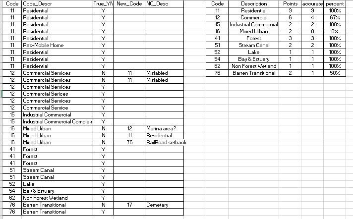
Of the 30 sample points 24 of them were classified correctly for an overall accuracy of 80%. The smaller table above shows the accuracy broken out by classifications. Mixed Urban had 0% correct. Since I utilized this class for areas that I could not completely identify when classifying it is reasonable that with additional data the need for this classification would be eliminated.
No comments:
Post a Comment